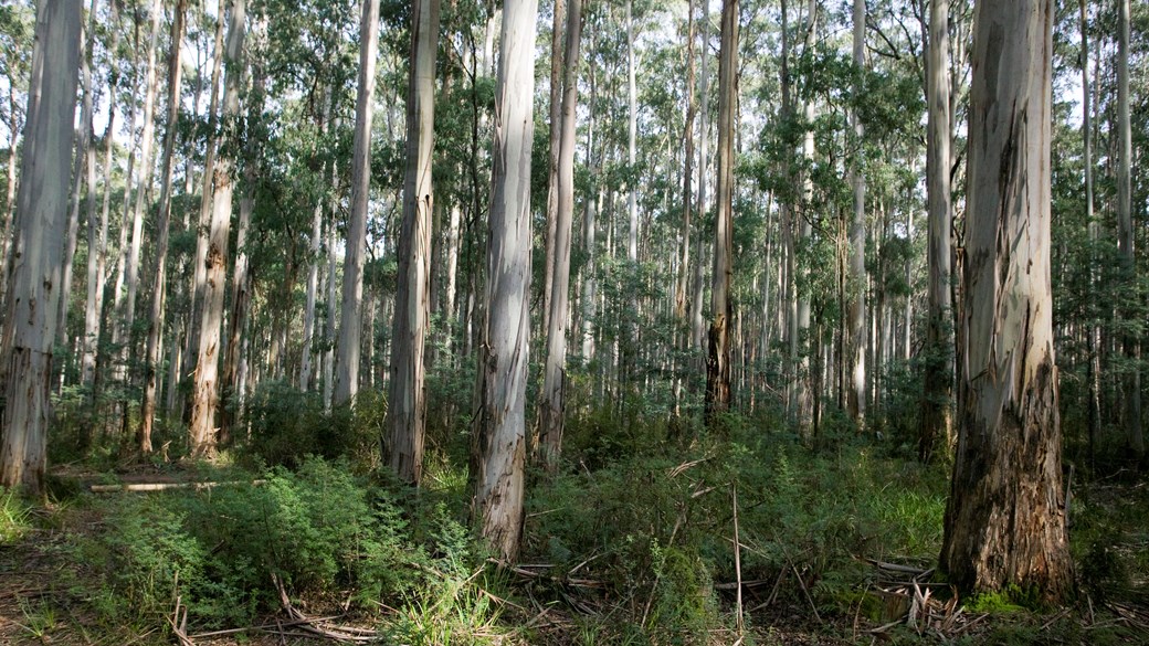
The forested mountains which embrace the city of Melbourne are the setting for giant trees, dramatic geological events, human stories of tragedy and triumph, evolution of unique organisms and regular occurrence of bushfires.
Water has shaped the mountain landscapes we can see today east of Melbourne. Australian geologists and indigenous people have developed separate explanations for the creation of the landforms we see today, both of which attach particular importance to the action of water. A Kulin creation story tells how landscape was formed.
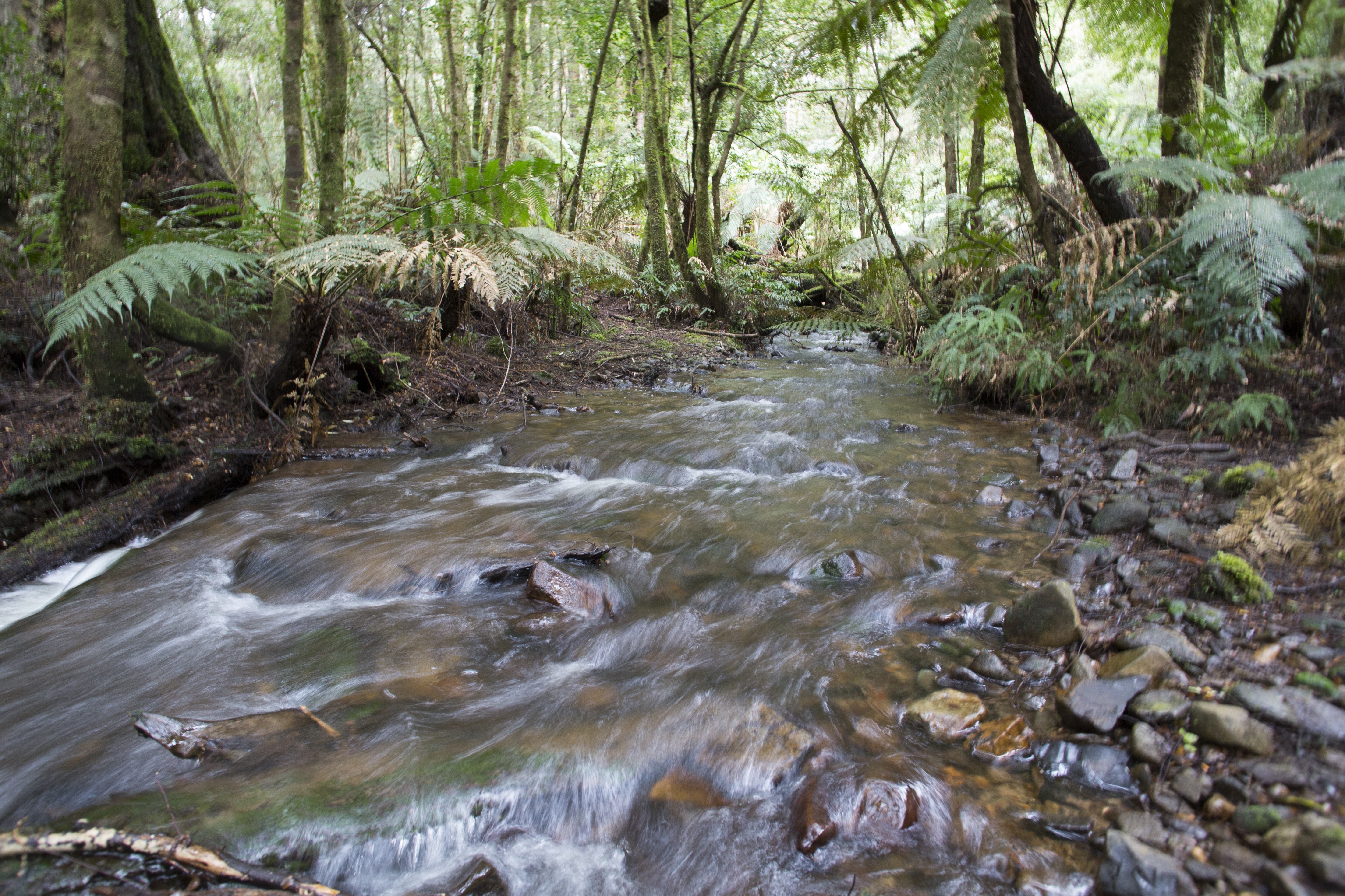
The creeks and rivers are home to a range of animals which interact in a dynamic food chain. The water that is captured by the mountains provides us with our high quality water supply.
Shaping the landscape
The mountains east of Melbourne have been built by a series of geological events and shaped by a long, continuing process of erosion from water.
There are five clear phases in this process from 500 million years ago until today:
Assembly phase: 500–370 million years ago
The eastern part of the Australian continent didn't exist at all at around 500 million years ago. From about this time through to 370 million years ago (a period of some 130 million years) eastern Australia was assembled from a number of continental fragments that arrived from the east (driven by plate tectonic processes, i.e. continental drift) and collided with the existing crust.
The continent-continent collisions folded and distorted the crust along the line of collision, creating rugged mountains. Landslides, scree and boulder strewn valleys would have been common. Some of the crust that was pushed downwards by this collision reached temperatures sufficient to melt the rocks. The molten material (magma) was pushed into the deformed sedimentary rocks where it cooled and crystallised to form granite.
U-shaped valley in New Zealand
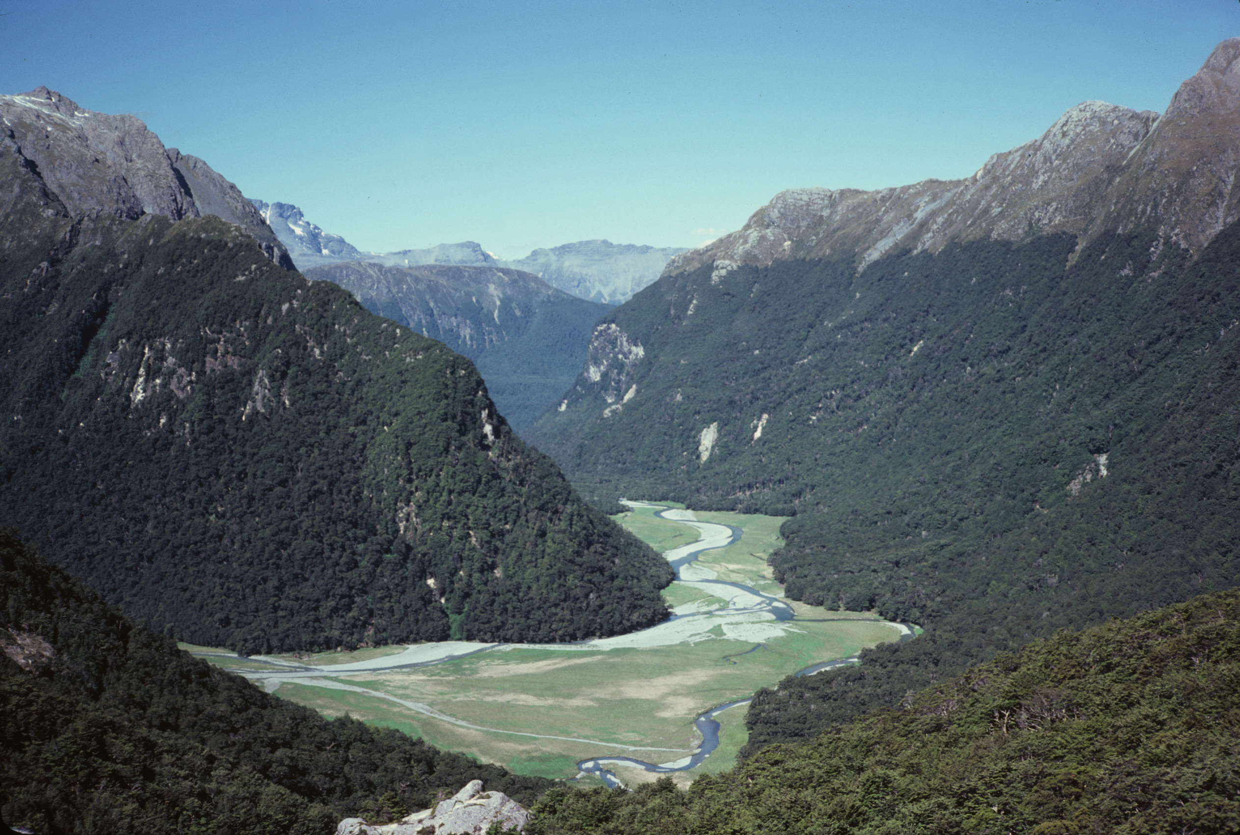
Glaciation phase: 290–270 million years ago
During the Permian (290 - 270 million years ago) Gondwana (of which Australia was a part) was located close to the south pole. Because of its polar location Australia was partly covered by a major ice-sheet at this time (similar in size to the present East Antarctic ice-sheet).
As Gondwana moved northwards to lower latitudes the ice-sheet would have melted and the final phase of the glacial activity would have been mountain glaciers within the highland region of eastern Australia (similar to the present mountain glaciers in the Southern Alps of New Zealand). These mountain or valley glaciers scoured steep U-shaped valleys through the mountainous topography.
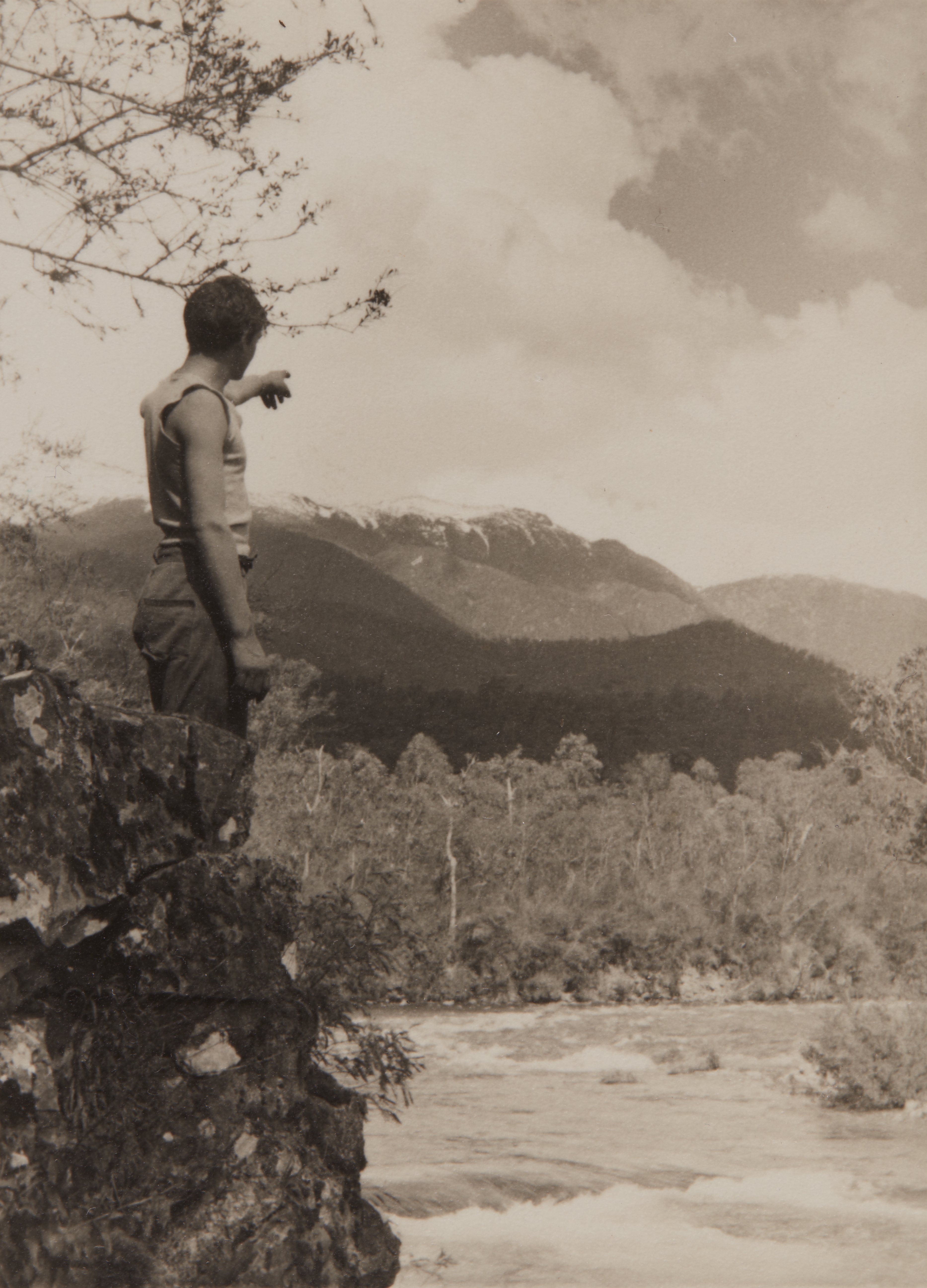
Mountain-building phase: 250–200 millions years ago
Snowy Mountains Hydro-Electric Project, Peter Cockburn Overlooking Windy Creek, New South Wales, circa 1952
The eastern margin of Gondwana was rimmed by a major subduction zone as in the South American Andes mountains of today. A subduction zone is where the continental edge uplifts as the colliding continental plate slides beneath it. This process reached a peak between about 260 - 230 million years ago and was the last major mountain building event to have affected the eastern Gondwana margin. It added the finishing touches to the creation of the highlands across south-eastern Australia.
Ongoing and vigorous erosion of the highlands since they first emerged back around 370 million years ago, by rivers and glaciers, would have exposed some of the early-formed granite. Erosion would have continued at an even greater pace immediately following this final phase of mountain building as rivers quickly carved into the high topography.
Breaking-up phase: 100–70 million years ago
At about 200 million years ago Gondwana began to break up into smaller continental fragments and the modern continents began to take on their present identity. Australia emerged from eastern Gondwana with the formation of the Tasman Sea and the separation and movement of Antarctica to the south.
The break-up process involves extension (stretching) and thinning of the crust (the opposite of the mountain building process) until it ruptures along a line called a rift zone. The crust is literally pulled apart within these zones and ultimately replaced by molten material that upwells to fill the gap from the mantle below. The best example of an active rift zone is the East African Rift Valley in Kenya or the Red Sea Rift and Gulf of Suez.
The rifting process produced elevated and steep escarpments facing the nascent oceans and new rivers draining these steep escarpments started a new phase of erosion along the margin of south-eastern Australia.
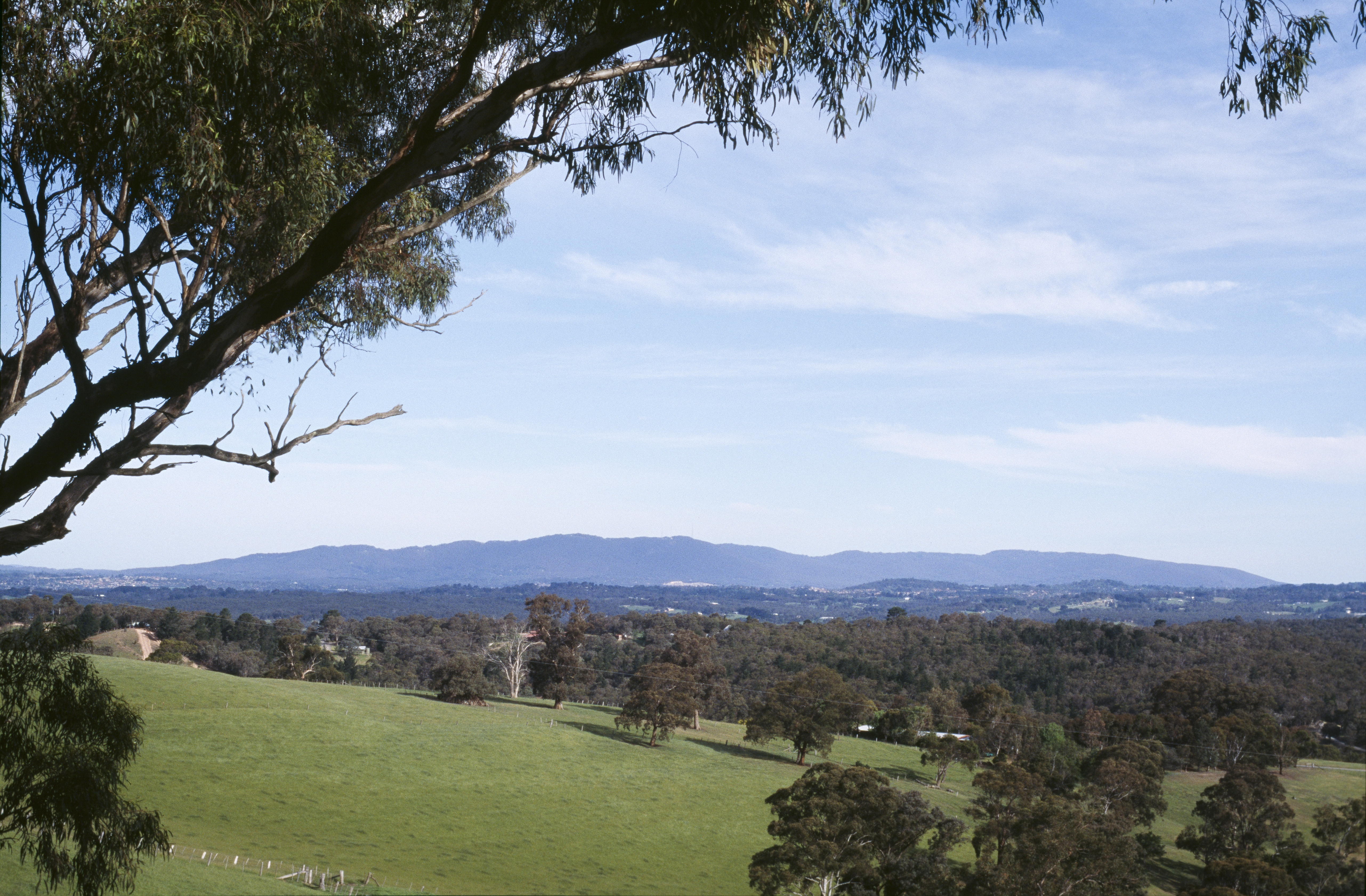
Today's mountain catchments: 0 million years ago
View of Dandenong Ranges (forested plateau) from Doncaster
The present highlands of south-eastern Australia represent the remains of a deeply eroded mountain chain with a protracted and tortuous history starting about 500 million years ago. Erosion of the topography is ongoing and the present rivers will continue to erode for millions of years into the future until the highlands of south-eastern Australia are completely worn away and the landscape returned to a flat, undulating plain. Unless, of course, another mountain building event intervenes in the mean time!
How the Yarra was formed
A Kulin creation story
The 'great water', Moorool, was locked in by the mountains.
Barwool, the Wurundjeri Elder, decided to release the great water so he cut a channel up the valley using his stone axe. But he was stopped by Baw Baw. He headed north and was again stopped by Donna Buang and his brothers.
Creek and boardwalk in Wirrawilla rainforest
Barwool turned westwards and cut through the hills to Warr-an-dyte where he met Yan-yan, another Wurundjeri man. Yan-yan was cutting a channel with his stone axe to free Morang, the 'great water' from his country.
The two men joined forces and the waters of Moorool and Morang became Moo-rool-bark - the place where the wide waters meet. They continued cutting a path for the waters of Moorool and Morang and so the Yarra River was formed.
Using many axes now they cut a narrow twisting track looking for softer ground until they reached a place where the waters rushed out creating Port Phillip Bay.
Life in water
Forest streams are usually well shaded. Thus little sunlight reaches the stream and the level of production of plant matter (known as primary production) is low. Consequently the potential for primary production in this habitat to support animal life is very limited. It has been discovered that forested streams rely on the input of organic matter from surrounding trees, usually as leaves but also as bark and wood, to fuel the food chain.
This type of organic material is not readily digested by stream animals, but is soon colonised by a variety of aquatic fungi and bacteria that can decompose it. These microbes can in turn be digested by some aquatic insect larvae and other freshwater invertebrates that can chew up large pieces of organic matter such as leaves. The leaves are thus carriers of high quality food (the microbes) even though they themselves are not particularly valuable as a food source.
As the leaves get chewed into smaller particles the surface area available for colonisation by fungi and bacteria increases and the decomposition process speeds up. Thus the decomposition of organic matter is a major pathway of energy flow in forested streams and is a important biological process that sustains the quality of these ecosystems.
Catchment - Melbourne's water supply
All of Melbourne's water comes from a series of weirs and dams in the forest-clad mountains east of the city. Melbourne enjoys a town water supply of excellent quality. The main reasons for this involve the geology and the management of the forested catchments.
The mountains cause moisture-laden air to rise, cool and release the moisture as rain and snow. Thus the rainfall is far higher in the mountains than in flatter areas around Melbourne. A certain amount runs off immediately into the rivers but much will be 'captured' by the dense forest vegetation, percolate through the soil and reach the water table. The water table contains the ground-water, which is confined within porous aquifers, and which emerges from the ground at springs to form creeks. Such ground-water enables creeks to keep running even if dry weather prevails. The levels of dissolved material in these streams is naturally very low because they flow through an ancient landscape; most of what could be dissolved was washed away long before Europeans decided to use these streams as sources of water. The water is therefore very pure.
From the 1870s, authorities began to set aside water catchment areas and prohibit farming and logging in these large areas of the forest. The initial impetus for this was to improve public health in the city by ensuring that fertilisers, silt or human settlement did not pollute Melbourne's water. Later, the argument moved to water quantity once it was understood that 'untouched' mature forests produce more stream-water flow than forests which have been logged and have more vigorous thirsty regrowth trees.
Aerial View of Maroondah Dam catchment
The policy of catchment protection has ensured that Melbourne's water is of an excellent quality, but the argument about the effects of timber-getting on water quality and quantity continues. Water authorities claim that logging will reduce stream flows, silt up the reservoirs, and pollute the water, and that the water would need to be further treated before it is suitable for domestic uses. Timber authorities argue that scientific logging need not undermine the water yield and purity from the catchments, and present social and economic reasons in favour of harvesting the catchment areas.
About 300 hectares (out of the 157,000 hectares) of water catchments is logged each year by the Department of Natural Resources and Environment. Measures in place to minimise the impact on water quality and yield include leaving buffer zones along streams and installing drainage on logging tracks. Melbourne Water makes sure that the roads are well-maintained, so that access is easy for fire control.
The forest has been viewed by the water authorities as a source of pure water, an abundant resource which could allow the expansion of suburban Melbourne. Country interests argue that this growth of Melbourne is at the expense of country areas, and that some of the forest water should be used in irrigation schemes north of the range.
The building of reservoirs, dams and water channels to transport water from the hills to the houses of Melbourne was an impressive surveying and engineering feat. Engineers met the challenge of damming valleys and diverting streams. The areas around the dams were landscaped, becoming picnic areas planted with introduced trees; these are now favourite parts of the visitor's experience of the Mountain Ash range.
Access to many catchment areas is limited - they are closed to public entry and open only to bushwalkers (on specified tracks), university researchers and fire fighters. The majority of the catchment area now forms part of the Yarra Ranges National Park or the Kinglake National Park.
Because of this, large parts of the Mountain Ash forest have been protected, and are nearly in a 'wilderness' state. These developments indicate how the economic value of the forest (in this case its role in producing water for the city) has led to a preservation and fostering of wilderness areas.
Earth
Earth movement
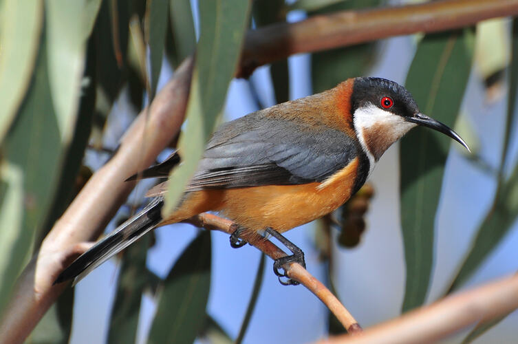
The tall eucalypt forests in the mountains east of Melbourne contain a large number of plants and animals which are found only in Australia. They bear little resemblance to those of other continents. This seems logical - after all Australia is an island with flora and fauna which is largely separate from the flora and fauna of other continents.
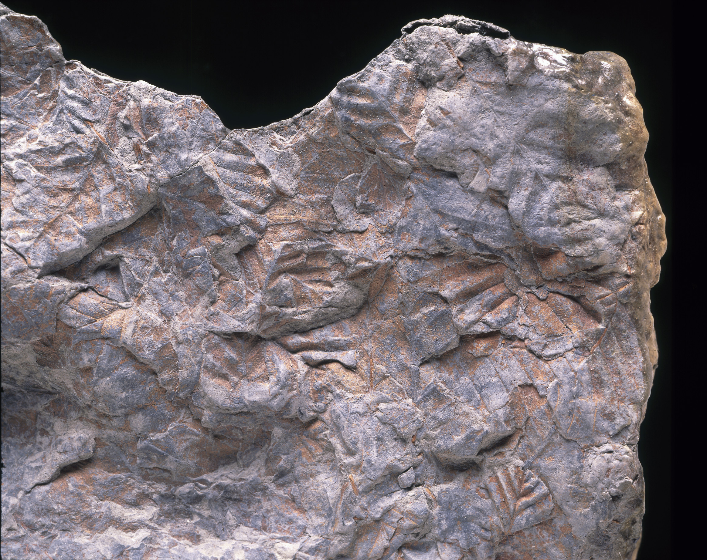
Nothofagus (Southern Beech) fossil imprints
In the protected damp gullies and along southern aspects, there are pockets of a very different type of forest - different from the eucalypt forest but uncannily similar to certain forests in New Zealand, South America and other lands separated by vast oceans. This cool temperate rainforest is even represented in Antarctic fossils. How could this have come to be? Evidence derived from rocks, fossils, plant and animal taxonomy suggests an explanation - a dramatic history of moving continents, changing climates and evolutionary processes.
Drifting continents
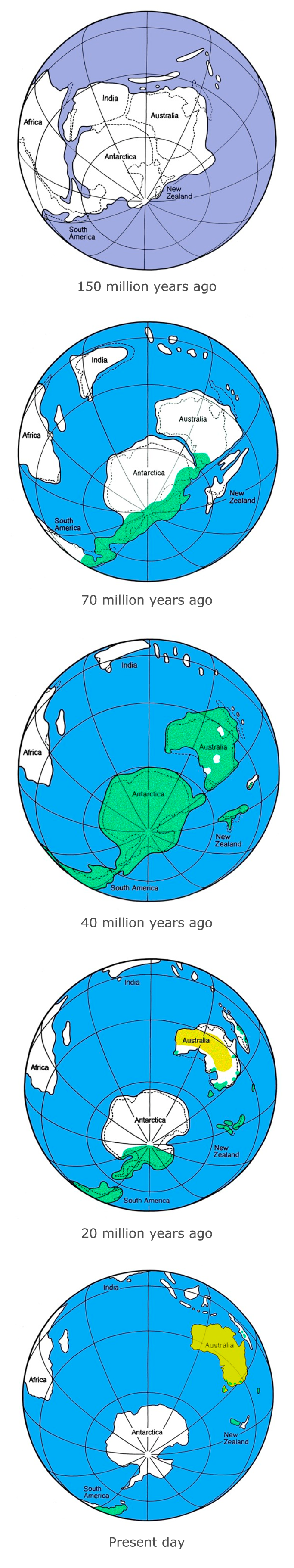
Illustration of Gondwana 150 million years ago to present day.
As long ago as the middle of the eighteenth century, it became apparent to some palaeontologists that there were sometimes striking similarities in the types of fossils found in rocks of the same age in widely separated continents. These similarities could not be satisfactorily explained by the migration of plants and animals across vast expanses of ocean.
With the development of the theory of plate tectonics in the 1960s which led to the widespread acceptance of continental drift, the similarities in the plants and animals of different continents could be readily explained by the drifting apart of land masses that formerly lay together.
Deep in the mountain forests east of Melbourne there are plants and animals which hark back to this ancient connection, the Living Relics, and there are others which mark Australia's more recent separateness, the New Flora and Fauna.
Amongst scientists there is widespread acceptance that South America, Africa, Arabia, Madagascar, India, Antarctica, Australia and New Zealand were once joined together in a supercontinent known as Gondwana.
The Southern Beech tree (genus Nothofagus) evolved about 80 million years ago in the cool, temperate climate of southern Gondwana. The super-continent of Gondwana had already begun to break up by this time, but South America, Antarctica, Australia and New Zealand were still connected. Nothofagus spread to all these regions (shown in dark green).
Nothofagus was dominant in many parts of south-eastern Australia in the cool, moist climate of 40 million years ago. At about this time, the last links between Tasmania and Antarctica were broken, and Australia drifted north. Antarctica became colder and its forests died out.
By 20 million years ago, south eastern Australia was becoming drier as the continent floated north into drier latitudes. Bushfires became more frequent. Fire-adapted Eucalyptus forests (light green) were evolving and beginning to replace Nothofagus forests (dark green) in many areas.
In more recent times, grasslands and Eucalyptus forests (light green) have become the norm in Australia, and Nothofagus forests (dark green) are now restricted to isolated pockets of the Eastern Highlands of Victoria, NSW and south-east Queensland and the Central Highlands of Tasmania. They are also still found in Papua New Guinea, New Zealand, southern South America and New Caledonia.
Living relics
Some Australian animals and plants look much the same today as they did in the time of Gondwana.
They first appeared when the southern continents were joined, and have survived the long journey of Australia as an island. These living things have close relatives on other southern landmasses such as South America and New Zealand which are now separated by vast oceans.
Australian continent separated from Gondwana and moved northwards into drier latitudes, new species which could survive and thrive in the changing conditions evolved from the ancestral Gondwanan stock.
These forests of eucalypts and acacias and the animals which depend on them have come to dominate the Australian landscape. The wet forest dominated by Eucalyptus regnans is an example of this kind of recently evolved ecosystem.
The four seasons of the European tradition: summer, autumn, winter and spring, reflect the culture and environment of Europe but do not adequately describe what happens in the tall forests of Victoria.
The indigenous people of the region, the Kulin, have a detailed understanding of the annual cycle of seasonal events in the Upper Yarra Valley and the pattern of change marked by the association of movements in the night sky and changes in the biology and weather.
Biologists have insights into the forest ecosystem through collection and analysis of field data including how species respond to seasonal change. Both indigenous and scientific knowledge provide a rich picture of the how the tall forest changes throughout the year.
Eastern Kulin Seasonal Calendar
The lands of the Eastern Kulin people include the Dandenong Ranges, near Melbourne, which they refer to as the 'cold country'. The Kulin have a detailed local understanding of the seasons and the environment. Each season is marked by the movement of the stars in the night sky and changes in the weather, coinciding with the life cycles of plants and animals. Overlaid on the seven seasons are two other non-annual seasons - Flood season which is likely to occur on average about every 28 years, and Fire season which occurs on average about every seven years.
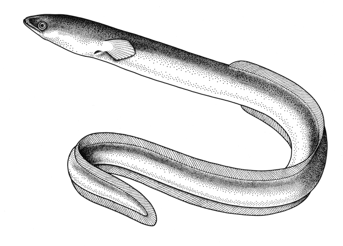
Iuk Eel Season (March)
Iuk - Southern Shortfin Eel (Anguilla australis)
Hot winds cease and temperatures cool.
Iuk (eels) are fat and ready to harvest.
Binap (Manna Gum) is flowering.
Days and nights are of equal length.
Lo-An Tuka, the Hunter, is the star Canopus, seen almost due south at sunset.
'We used to set a fishing line at night time, mostly in the lagoons. We got eels out of that… they'd go down to where Badger Creek runs into the Yarra. If eels were running that plentiful they'd make a net and put that in.' Martha Nevin, 1969.
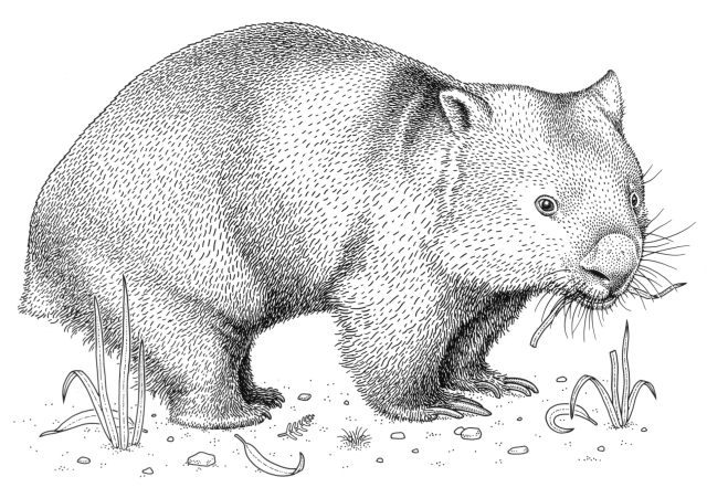
Waring Wombat Season (April-July)
Waring - Wombat (Vombatidae sp.)
Cool, rainy days follow misty mornings. The time of highest rainfall and lowest temperatures.
Waring (wombats) emerge to bask and graze in the sunshine.
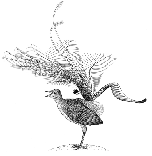
Bulen-bulen (Superb Lyrebird) males perform their courtship displays.
Hearts of Kombadik (Soft Tree-ferns) are the major food when no fruits are available.
Days are short and nights are long.
The constellation of Sagittarius rises in the southeast after sunset, indicating the mid-point of cold weather.
'Wumangurruditj, that's wombat. Put a piece of wombat, a piece of pork and a piece of porcupine [echidna] and you can't tell the difference.' Jessie Hunter, 1999
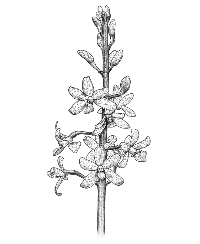
Guling Orchid Season (August)
Guling - Hyacinth orchid (Dipodium roseum)
Cold weather is coming to an end. Guling (orchids) are flowering.
'The orchids, that's those little ones. They grow down on the flat too across Badger Creek - has a little flower like a star. If we had a headache Granny Jemima would pick that and boil it and give you a very little bit to drink.' Jessie Hunter, 1999
Ae-noke (caterpillars) of Common Brown butterfly feed on grasses at night.
Muyan (Silver Wattles) are flowering.
Bulen-bulen (Superb Lyrebird) males perform the last of their courtship displays.
The star Arcturus is seen on the northwestern horizon soon after sunset.
Gurrborra (Koalas) begin mating. Males bellow at night.
Temperatures are rising but the rain continues. Flax-lilies are flowering.
'You get a frog and tie his back legs and then put a great big cod hook . . . And you'd have to put a weight. Otherwise you'd see the frog back on the log . . . You'd catch a codfish that way.' Martha Wandin Nevin, 1969
Pied Currawongs call loudly and often.
The flowering of plants such as Myrnong, (Yam Daisy), indicates the tubers are ready for eating.
Bulen-bulen (Superb Lyrebird) males have finished displaying.
Days and nights are of equal length.
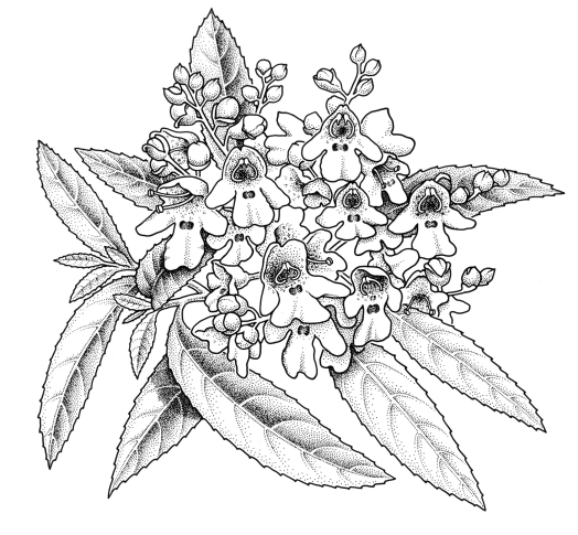
Buath Gurru Grass Flowering Season (November)
Coranderrk - Victorian Christmas bush (Prostanthera lasianthos) in flower
The weather is warm, and it is often raining. Kangaroo Grass is flowering.
'They must have done something with the seeds for damper to pulp down into a floury thing for damper. That's when the butterflies come to the flowers. They were food.' Brian Paterson, 1999
Buliyong (bats) are catching insects in flight. Balayang, the Creation Being, is also referred to as the bat.
Male Common Brown butterflies are flying. Coranderrk (Victorian Christmas Bush) is coming into flower.
The Orion constellation is setting in the western sky around sunrise.
Kangaroo Apple (Solanum aviculare)
Kangaroo-apple Season (December)
Changeable, thundery weather.
Dhuling (Goannas) are active.
Buliyong (bats) are catching insects in flight.
Days are long and nights are short.
'Usually when a storm's coming, rain birds, black cockatoos, yellow crested, they come down from the mountains. And you can bet on it within two or three days it rains. Never fails. Two days and it rains. And they make a racket.' Brian Paterson, 1999
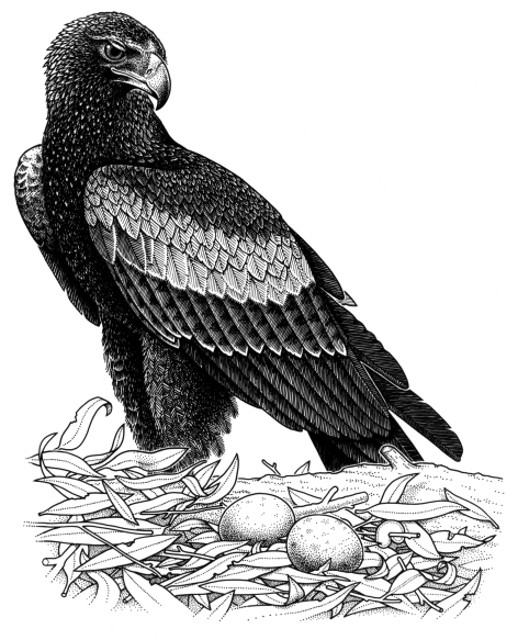
Fruits appear on Kangaroo-apple bushes. Bali (Cherry Ballart) is fruiting. Bundjil (Wedge-tailed Eagles) are breeding. Bunjil, the Creation Being, is also referred to as the 'eaglehawk'.
Bundjil - Wedge-tailed eagle (Aquila audax)
Biderap Dry Season (January-February)
Common Brown Butterfly (Heteronympha merope) adult
Hot, dry weather. High temperatures and low rainfall.
'I don't know why, we used to play around the tussock grass. Playing hidey. So they must have been big enough to hide around. And it was nothing to see a snake curled up inside the tussock grass.' Dot Peters, 1999
Female Common Brown butterflies are flying.
Bowat (tussock-grass) is long and dry.
The Southern Cross is high in the south at sunrise.
Mountain Ash forests as carbon sinks
The Mountain Ash forests of the Victorian Central Highlands contain the world’s highest known biomass carbon density, or stored carbon. This is particularly so for 'old growth' stands containing Mountain Ash trees between 100 and 500 years of age.
These forests have high carbon stocks for a number of reasons:
Characteristics of individual trees Mountain Ash are evergreen, with some growth occurring throughout the year. Mountain Ash wood is extremely dense, enabling storage of large amounts of carbon, and the trees grow to over 100m tall and 6m in diameter.
Characteristics of the forest environment Mountain Ash trees have a thin canopy which allows a luxuriant evergreen understorey to flourish. Typically they grow where there is high rainfall (1670mm, O’Shannassy catchment) and deep fertile soils that encourage rapid growth. Mountain Ash trees usually grow on a southerly aspect with a cool mean annual temperature (9.4 degrees C, O’Shannassy catchment). These cooler wetter conditions contribute to long intervals between wildfires, with fires that do occur being relatively less intense.
Land use Human activity has had little impact on those old growth Mountain Ash forests remaining intact today. They have not been subjected to timber harvesting, or land management practices like the Indigenous firestick farming undertaken in many other forest types in the past.
This means the loss of carbon through decomposition and respiration is lower than the rate at which it is gained through plant growth. In old growth forests this ‘net gain’ of carbon has been occurring for hundreds of years.
High rainfall and lush vegetation means that bushfires occur rarely in Mountain Ash forests. But when extended drought comes, the huge quantity of flammable material can mean bushfires will be intense. Such fires are essential to the forest's existence.
Bushfire kills the Mountain Ash, and yet it is only in the aftermath of wildfire that its seed germinates and grows. Anywhere Mountain Ash forest exists, there must be a history of bushfire. Its birth was the date of the last big fire.
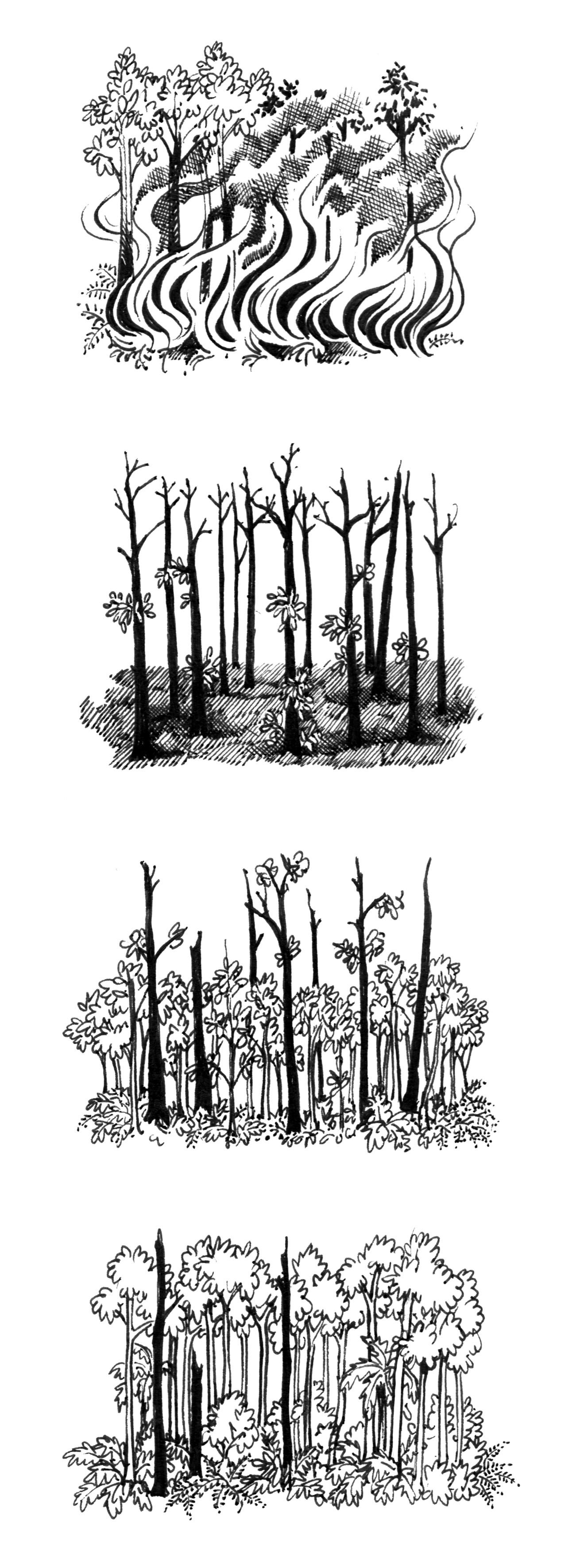
Illustration showing the impact of bushfire and the stages of forest regrowth.
After fire the forest regenerates, changing in plant and animal structure over the decades or centuries until the next big fire. This sequential change in species inhabiting the forest over time is called succession. There is no 'climax' stage as is commonly found in northern hemisphere forests.
Mountain Ash forests are in a constant state of successional change. The life history stages of the Mountain Ash are useful markers of successional change in the wet forest environment. These stages are: Germination, seedlings, saplings, pole, spar, mature and old growth.
Wildfire
Regeneration of Mountain Ash requires a periodic hot and fast bushfire in a forest of trees of at least seed-bearing age. Mountain Ash forests naturally experience a crown fire possibly every 100-200 years-a fire that destroys the forest but results in dense regrowth. Such a crown fire is only possible after a number of years that result in dry fuel, low humidities and high temperatures.
The future succession of the sites will depend upon the frequency of subsequent fires. Fires less than 20 years interval (i.e. before trees are old enough to set seed) will see the elimination of Mountain Ash altogether and other species will dominate; fires every 2-3 years will result in domination byPteridium esculentum; every 5-8 years,Cassinia aculeatum, and every 10-15 years,Pomaderris aspera.
Fire seldom penetrates the gullies colonised by the fire-sensitive Myrtle (or Southern) Beech. This absence of fire is the major determining factor in the Myrtle Beech range. Logging practices and clearing for other purposes also create major disturbance in the forest, yet it is to bushfire and occasional canopy disturbances with their more limited soil disturbance that the plants are adapted. As a result, logging and clearing results in a succession of flora which is different from that produced by bushfire.
Wildfire reduces ground-layer invertebrate activity by up to 90%; the number of different groups of these animals (taxa at the higher levels) is reduced by up to 60%. Yet groups such as spiders, mites, beetles, flies, ants and wasps are active after the fire. Some groups (eg ants) are more active after a fire than before. Although mammals and birds can escape from fires of low to medium intensity, this may be short-lived in the long term unless they survive in unburnt remnant vegetation. While an intense wildfire may kill all trees, the presence of dead and burnt stag trees for shelter is important for many animals such as the skinkPseudemoia spenceri.
Germination
Wildfire burns the leaves and kills the Mountain Ash trees but does not burn capsules in the crown that hold seeds; the rapid passing of fire probably protects the capsules.
Mountain Ash only regenerates from the seed that drops out of the crown after a fire. In a good flowering year, there could be as many as 14 million seeds/ha in the forest crown. An estimated 200,000-250,000 fertile seeds/ha is dropped each year and 60% of this seed fall is harvested by ants; there is no soil storage of seed.
Eucalyptus regnans, Mountain Ash, seeds on a finger
Without a fire, the few seeds that do germinate do not survive because they succumb to low light levels, fungal infection, insect attack and marsupial browsing.
After a wildfire, there is an enormous seed drop which swamp the seed-harvesting ants and lygaeid bugs. The seeds germinate in the nutrient rich, sunlight-flooded ash bed.
Seedlings
After a wildfire up to 2 million Mountain Ash seedlings germinate per hectare.
There are three main seedling stages: the two leaf stage with plants up to 2.5 cm in height (up to 3 weeks after germination), 10-15 cm tall plants with 3-5 pairs of leaves (3-4 months), and rapidly growing seedlings up to 3 m in height (2 to 4 years).
The tap root increases in size from 20 cm in the first year to over 1.5 m in the third year.
The lateral root system expands from 7 cm in the first year to over 2 m in the third year.
Seedling tray in the Forest Gallery
Saplings
This is a rapid growth phase when Mountain Ash trees grow to heights of 12 metres within 10 years of germination. Sinker roots develop from the main lateral roots. The mortality rate is still very high, and the density of plants in 16 year old forests is 2,000 plants per hectare. A leaf litter layer forms on the ground.
The abundance of certain invertebrate groups increased after wildfire: mites, springtails and insect larvae. Groups such as isopods and amphipods (crustaceans) recolonise as the leaf litter layer develops. Mammals such as the Agile Antechinus, Antechinus agilis, appear.
Pole stage
Sylvia Creek Road Eucalyptus regnans, Mountain Ash trees
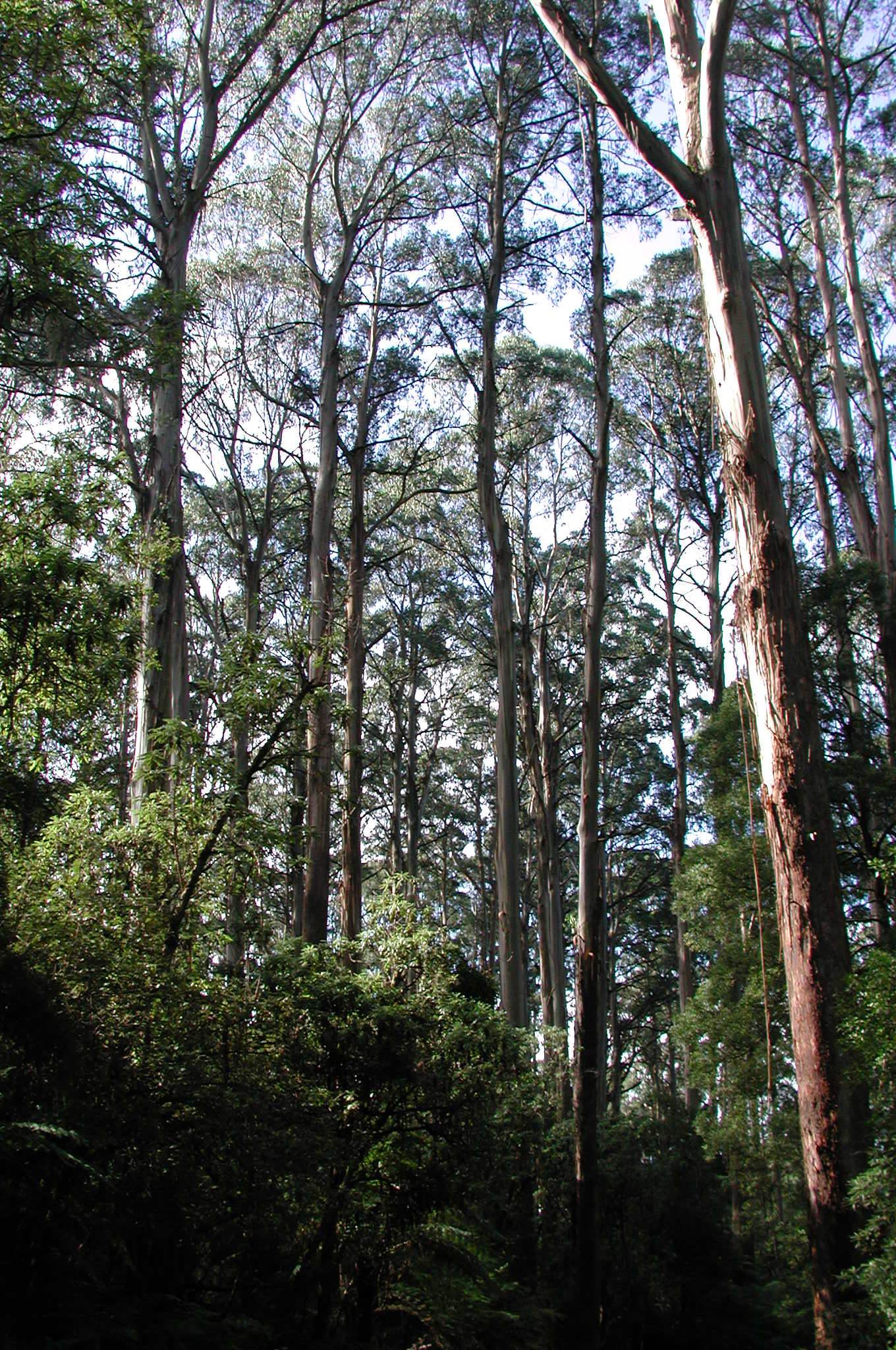
The pole stage of Mountain Ash is 15-30 years, and by this time the trees are 15-35 m in height. The crown is characteristically pointed as in the sapling stage as all effort goes to attaining height. The trunks thicken out; there is straight growth (rapid height gain) and the forest reaches half mature height at 25-35 years.
The main tap root may die back. Lateral roots extend to up to 7.5 m. There is bark formation on the butt. At around 20 years, the trees 'mature'-they flower and seed is produced. Weaker trees continue to die out in favour of their more vigorous neighbours.
Fine woody debris collects on the ground and shed bark begins to pile up around the base of the trees. The Agile Antechinus feeds on invertebrates and lizards from the leaf litter.
Spar stage
Eucalyptus regnans, Mountain Ash (spar stage), view in forest
Spar stage is reached from about 30 years until about 100 years. Growth is rapid and the trunks remain thin relative to the increasing height, however gradually the crown begins to flatten out and lose its conical shape. There is still tree mortality: there is a density of approximately 300 tree per hectare at 40 years. Leaf, bark and branch debris continues to thicken on the forest floor. Below ground, there is unlikely to be any remaining tap root, instead lateral and sinker roots develop further. Most fine roots are in the top 60cm of soil. Buttresses commonly develop at the tree's base, adding support to the rapidly growing tree.
After 25-30 years, Common CassiniaCassinia aculeatabegins to decline. Hazel PomaderrisPomaderris aspera, Musk Daisy BushOlearia argophyllaand Blanket LeafBedfordia arborescensdominate the understorey. Hazel Pomaderris goes into decline after 100 years. It is a heavy flowering species, and can produce up to 11 million seeds/ha. These seeds can be stored in the soil, and it is a species that can survive very frequent fires.
Mature trees
Mature Mountain Ash trees reach maximum height of 60-100 m after 100-300 years. They have a complex root system of wide-spreading lateral roots with sinker roots. They reach maximum leaf production and leaf litter production. Tree hollows form. There is an average of 40-80 trees per hectare at 150 years. There is a thick litter layer on ground (up to 8.1 t/ha) that provides cover for the Agile AntechinusAntechinus agilisand the Bush Rat,Rattus fuscipes. Lyrebirds turn over top soil. The lizardNiveoscincus coventryi, inhabits all stages of the forest, but is most common in forests aged 50-140 years.
BA 1250 –
Lantern Slide - 'The Baron,' Dandenongs, Victoria, 1890
Variation in habitat is important in the forest. Snakes are present in most forest stages, although like other reptiles which require the suns' heat to become active, they tend to congregate around suitable basking sites. Amphibians are dependent on suitable feeding sites, so some frog species, such asLitoria ewingii, tend to be near small streams or semi permanent water holes (such as fire dams). Other frogs, such asCrinia signifera,Geocrinia victorianaandPseudophryne bibroni, tend to breed in ephemeral areas, and often use old logging sites where they 'nest' in ruts and under bark. The ground-layer invertebrate fauna is dominated by springtails, mites, spiders, ants, beetles, flies and wasps, and to a lesser extent, centipedes, millipedes, amphipods and isopods.
Tree hollows are essential as nest sites for many vertebrates such as the maternal colonies of some forest bats, the Agile AntechinusAntechinus agilis, and large owls such as the Sooty OwlTyto tenebricosa. Eight species of arboreal marsupials live in holes in Mountain and Alpine Ash forests: the Feathertail GliderAcrobates pygmaeus, the Sugar Glider Petaurus breviceps, Leadbeater's PossumGymnobelideus leadbeateri, Yellow-bellied Glider,Petaurus australis, Common Ringtail,Pseudocheirus peregrinus, Greater Glider,Petauroides volans, Mountain Brushtail Possum,Trichosurus caninusand Eastern Pygmy Possum,Cercartetus nanus.
Old growth
Old growth Mountain Ash trees are 300-400 years old. The tops of the trees get damaged by wind, snow, insects and fungi and the tree height reduces to 30-60 m. Large branches fall to the ground. Trees begin to decline and die. Some die leaving grey branchless trunks or 'stags' which are important habitat features for many animal species, most notably Leadbeater's PossumGymnobelideus leadbeateriwhich has a preference for stags in late decline. If no bushfire comes to the area, the Mountain Ash trees will be recolonised by rainforest trees such asNothofagusif they exist nearby. The understorey is more open.
Logs on the forest floor are an often overlooked component of old-growth stands. They are important for a variety of reasons, including the return of nutrients to the soil and providing habitat. Logs are used for shelter, feeding, reproduction, basking and nesting. They are important habitats for many invertebrates, reptiles, and provide travel routes for small mammals, as well as being a concentrated source of invertebrates. They may offer nest protection for ground-nesting birds. Their moisture content makes them particularly important as amphibian habitats, including refuge area during fires. Fruiting bodies of mycorrhizal fungi are often found in decomposing logs and stumps. These provide insects and mammals with nutrients and energy. Logs are predominant among the debris in streams of old-growth forests where they provide shelter, fish and frog spawning sites and increased substrate diversity.
Fire and people
Bushfires effect not only the flora and fauna of the Mountain Ash forests, but also the people who calls these places home. In response to the 2009 Black Saturday bushfires, Museums Victoria established the Victorian Bushfires Collection which record the lived experiences of those who are impacted by bushfires, celebrates the resilience of these communities, and documents wider cultural reactions to these recurrent natural disasters. Please follow the link below to explore this collection.
People see the forest in different ways, and this influences how they interact with it. The forests have been seen as a sanctuary for biological diversity, a resource for economic benefit, a frightening, alien environment, a place of rest, recreation and renewal and as home.
The forests east of Melbourne have been seen as a resource for timber, minerals and gems. Aboriginal people have long connection to the area and a recent history of dispossession, displacement and repossession of land. The forests have drawn people as explorers and settlers and more recently as tourists but some have had the misfortune to be lost in the bush or killed by bushfires.
Different perceptions have always existed, although certain ones may have enjoyed more widespread influence at different times.
Timber
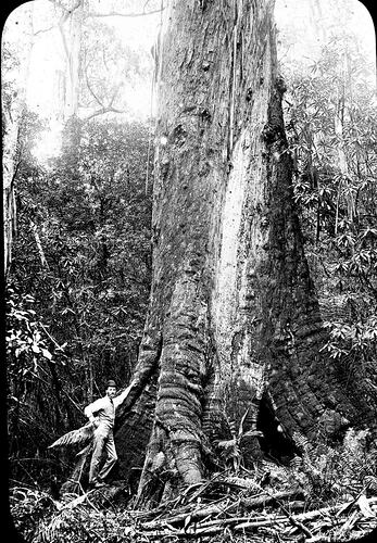
The Mountain Ash is the tallest hardwood in the world. It grows fast, straight and has few branches at its lower levels. It is understandable that the tall forests would become a favoured resource for timber production.
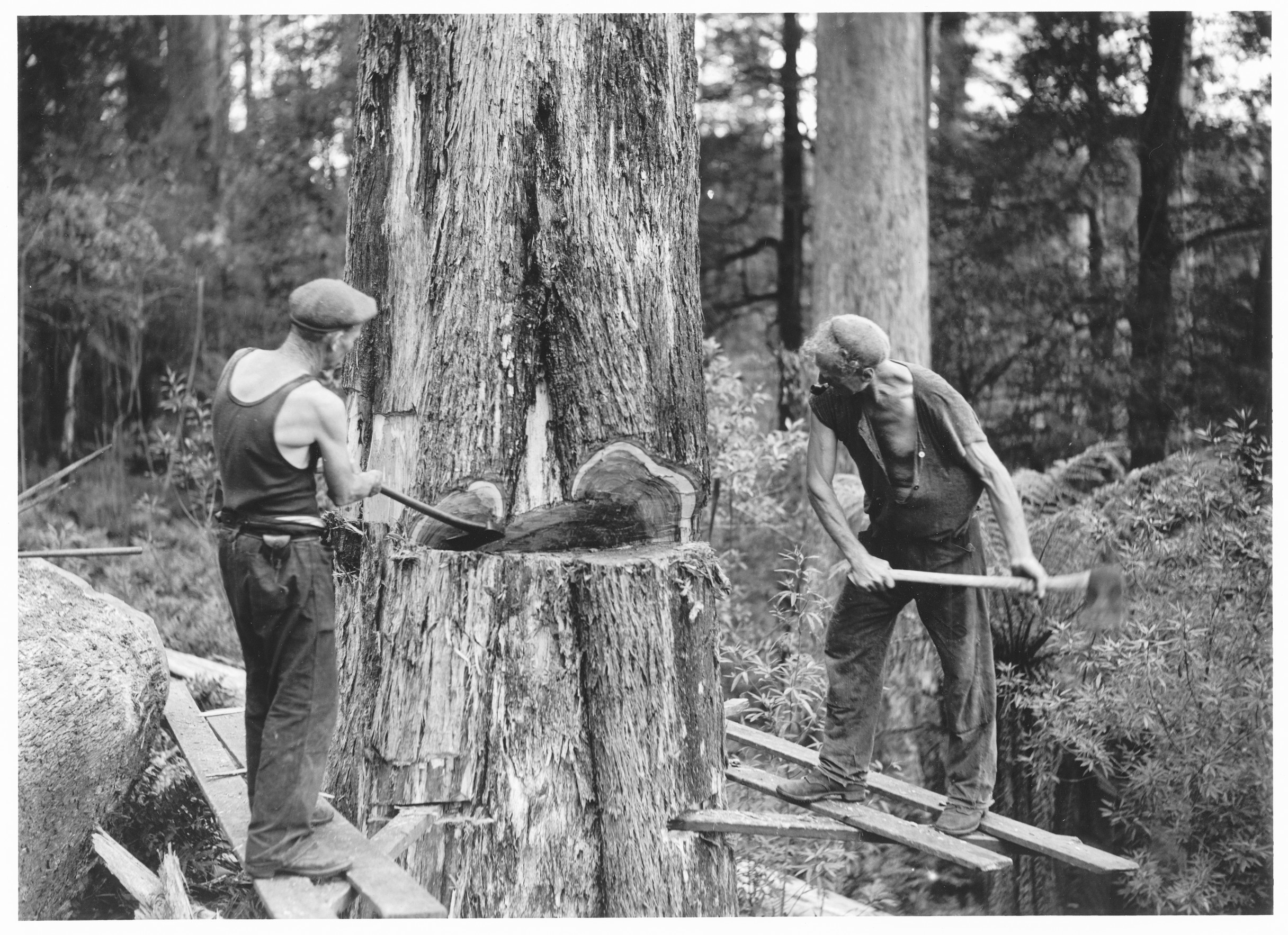
Two men commencing tree felling, 1936.
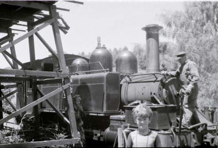
The first timber-getters were 'splitters' who felled trees and cut them up for palings and shingles for houses. They sought the largest and most accessible trees, travelling into the forests from the margins. By the early 1900s, many mills had been set up and timber tramways snaked through the forests to connect them to railheads. In the 1920s, kiln-drying and steam-seasoning techniques were successfully developed, so Ash timber could be used for a wider range of purposes. Steam winches enabled logs to be extracted from less accessible country.
Three Men Felling a Large Tree, Lavers Hill District, Victoria, circa 1910
Roads through the forest were later widened to allow huge timber trucks and earth-moving machines through, and the forest was criss-crossed with fire tracks to allow fire fighters access to even the most isolated valleys.
At first much wastage occurred, as many felled trees were discarded by splitters as unsuitable and left to rot on the forest floor. Timber companies established sawmills and began to employ men who worked for wages, and timbers other than the Mountain Ash were cut and treated. By the turn of the century, there was considerable concern at the operation of the timber industry in particular the practises being employed to recover timber. A Royal Commission led to the 1907 Forests Act and the establishment of a Forestry School at Creswick, to train foresters in the management and maintenance of the forest.
By the 1920s, timber companies were beginning to use steam powered winches, which made the timber in the steep ash forests accessible and millable. The reconditioning process with steam heating restored the timber's original shape and removed all stresses, making the Mountain Ash probably the most important forest tree in Victoria. Technology developed to improve the harvest yield: impressive aerial cable or skyline systems dragged or lifted logs across valleys to the mill; and tractors and new milling processes made the job easier. The ash forests were clearfelled, initially for economic reasons and then because it was argued that the forest had most chance of regenerating if this policy was followed.
It was a dangerous industry, requiring strength and bravery. Photographs and film show men sawing the tops off trees, linked to the ground only by a thin rope; climbers 'walking' up tall trees, and logs twisting in the air as they were winched across valleys. Accidents in saw mills were common, and many men lost fingers or whole hands. The industry was crippled by a strike of timber workers in 1929 and the collapse of demand for building timber during the Depression. Stockpiled timbers were washed away when the Yarra flooded in 1934; and many mills and their communities were destroyed in the 1939 bushfire. During the 1940s, much of the burnt timber was successfully salvaged, and then the emphasis turned to the exploitation of the re-growth forests.
Foresters undertook research on whether the ash forests could regenerate without fire. Botanists showed that tall forests need a catastrophe to survive, and that fire, light and forest-floor disturbance are all required for ash regeneration. The rise of the conservation movement in apparent opposition to the values of foresters has created a new dilemma for forest managers, and brought to the fore new questions about the effect of tree management policies on the ecology of the whole forest, including its fauna.
Mining and fossicking
The discovery of gold in Victoria in the early 1850s sparked a series of gold rushes and a vast increase in population. The first discoveries and rushes were inland, north of the Ash Ranges. Later, diggers and fossickers gradually began prospecting in the ranges, and the Emerald Field opened in 1858. There were brief-lived rushes along the Little Yarra and Upper Yarra rivers, Hoddles Creek, Britannia Creek, the Nicholson and Darling goldfields in the Yarra Valley, and in the Donovans and Walshes Creek areas in the late 1850s and early 1860s.
A fossicker seated outside his hut. He appears to be smoking a very long- stemmed pipe. His equipment includes a scythe and several buckets and pans used in gold prospecting . Moondarra was on the narrow gauge 2ft. 6ins. (762mm) Moe to Walhalla line
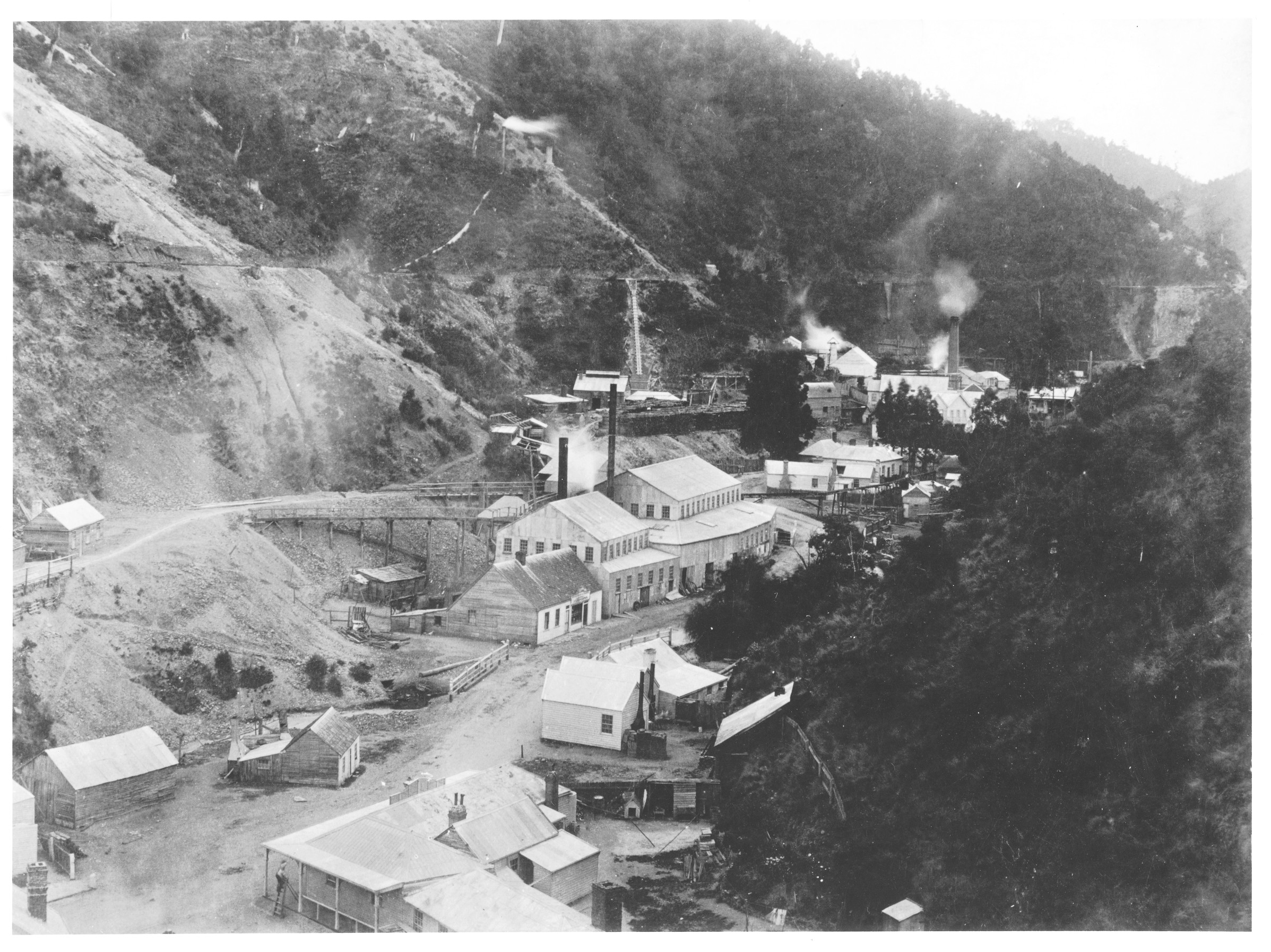
The major goldfield in the Ash Range was further east, the Jordan Goldfield (called this because 'it being a very hard road to travel'.) This followed the quartz reefs from Jamieson in the north, through Woods Point and Matlock, to Walhalla in the south. Gold lured prospectors and adventurers beyond the geographical barriers which had daunted their predecessors. In May 1861, spectacular quartz reefs were discovered at Woods Point, and alluvial gold was found in the Jordan Valley in 1862. By the end of that year, there were 4000 miners on the Jordan. The main town in the valley was given the name of Jericho.
Roads were not easy to make. In 1859 surveyor Hodgkinson reported 'I found it necessary to force a passage through such tangled scrub that I was occasionally compelled to crawl on my hands and knees to advance at all.' Mines were established in dark valleys and many miners were 'too much daunted by the aspect of the scrub to plunge into it with the view of seeking new ground.'
The Long Tunnel Gold Mining Claim 1886, Walhalla Township
The Government encouraged exploration and provided rewards for the opening up of the goldfields by tracks and roads. In 1862 the Yarra Track was opened from Melbourne to Woods Point, via Healesville, Fernshaw, Black's Spur, Marysville, and Matlock. Like several other tracks between and across the gold fields, it was cut through by individuals - miners, packers and storekeepers - trying to get access to the new finds. The tracks were steep and narrow, and it was a logistical achievement to transport the large pieces of mining equipment to the gold mines.
As alluvial mining finished, and mines went underground, the demand for timber grew. Miners were dependent on woodcutters to provide timber for steam power and to reinforce the tunnels underground, and the hills near the mines were soon denuded of trees.
The Jordan Goldfield was relatively shortlived. At Woods Point the boom had collapsed by the end of 1867, and the last gold was removed from Walhalla in 1915. Other minerals found within the range included tin, which was first found in 1876 and is still being mined; wolframite, an ore of tungsten, which was mined between 1901 and 1919; and copper, 1863 - 1881. Other gems sought by fossickers in the mountain streams include topaz, casseritite, tourmaline and quartz.
Lost in the bush
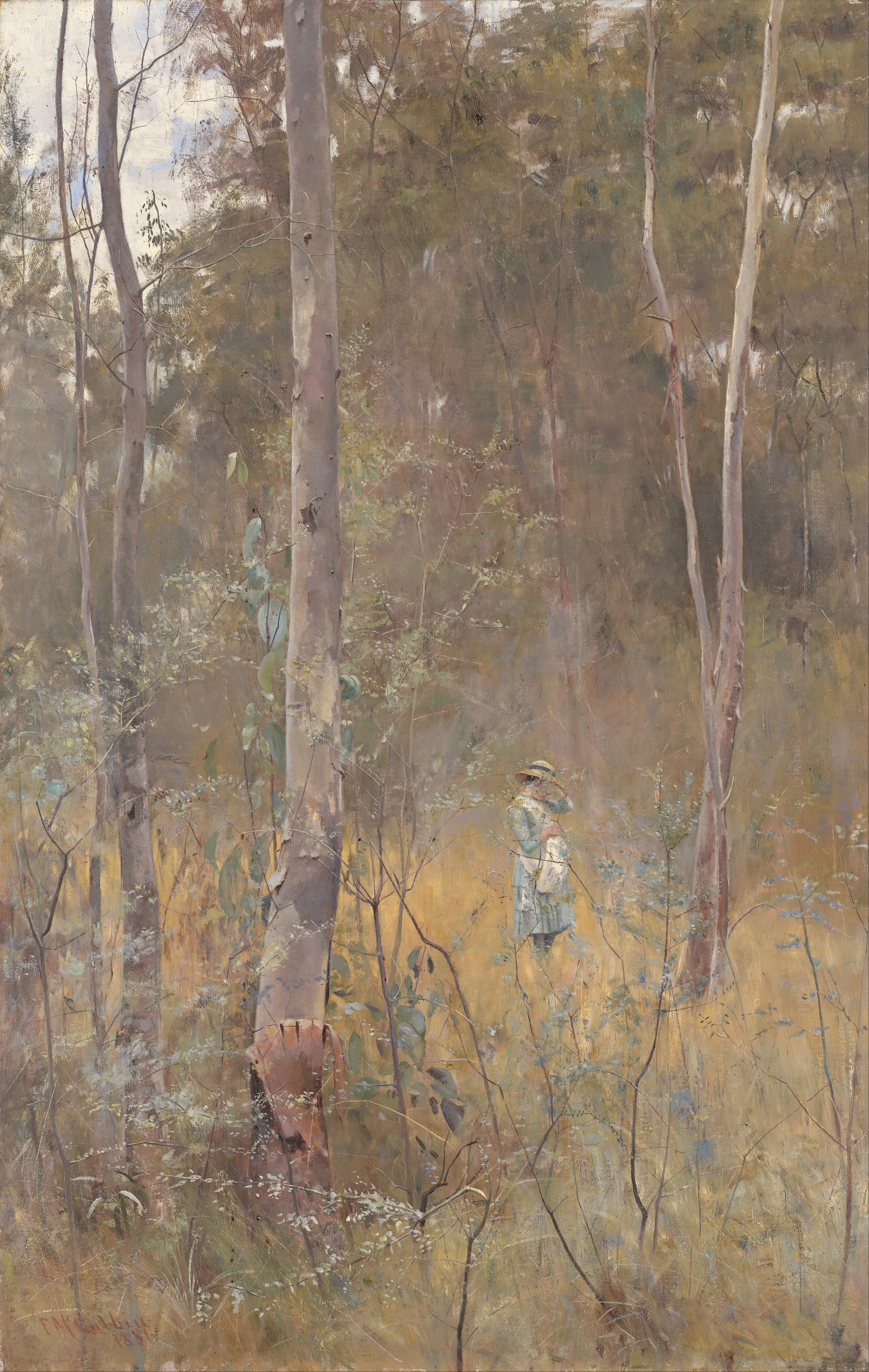
Many European settlers found the forests forbidding and alien: they used words like 'sombre', 'monotonous' and 'melancholy' to describe the Australian bush. The first British observers focussed on the grotesque perversities of nature. McCoy (1862) spoke of the forests' 'savage silence, or worse'. Poets tried to describe the contrast between the Australian and British landscape: Adam Lindsay Gordon, for example, wrote of the bush 'Where bright blossoms are scentless, and songless bright birds.' These quotations are evidence of an emotional alienation, a feeling of aloneness and abandonment.
"Lost" - Frederick McCubbin, 1886
Stories of people lost in the bush have become part of Australians' psyche. Children and adults lost their way, wandered away from picnic grounds, followed streams which seemed to lead nowhere, became lost and were never found. The artist Von Guerard was part of a group picnicking party at Fern Tree in 1858 when a young boy, Louis Viewsseux, became lost; the party searched frantically for him, but his body was not found until two years later. Patrick Moylette, a mounted policeman from the Emerald Station, became hopelessly lost in 1859; although his horse found its way back to settled areas, his body has never been found. Aboriginal trackers were often used in an attempt to find missing people. Illustrated newspapers published paintings with titles like Found-Too Late, which expressed a very real fear of the dangers in the bush. One of the most-read Australian children's books of early last century, Dot and the Kangaroo, took up the theme of the child lost and afraid in the bush.
The forest was also feared because of the strange and dangerous animals which were believed to inhabit it. The main fear was of snakes, and settlers and hikers walked warily, and carried snakebite kits. Many people still react with fear to the density, darkness and monotony of the trackless forests, and the presence of poisonous snakes and other 'unknown' animals creates insecurity and tension.
Faced with a strange, apparently hostile environment, and full of fear of the unknown, many people decide that the appropriate response is to 'tame' the environment. In the nineteenth century, to 'tame' meant to make more like 'home', more like a European landscape. Members of the Acclimatisation Society of Victoria, which was founded in 1861, introduced European birds and animals to the forest so that the 'bush solitudes' would be enlivened, and 'to give voice and life, activity and food, to where now ... the almost unbroken repose of ages holds its sway.' Members of the Society, including Professor McCoy, suggested that there was a moral purpose to this activity, as well as an aesthetic and economic purpose: homesick settlers, reminded of 'home' by the singing of introduced birds, would be inspired to poetry, the poor man's labour would be 'sweetened', and the drunkard would be softened and would repent of his ways.
Acclimatisation Society members and other settlers also tempered what they saw as the 'monotony' of the landscape by introducing exotic deciduous trees into areas like Fernshaw. In the process, they believed that they were beautifying the land, removing 'the doomed stringy barks' and replacing them by 'useful and ornamental trees, growing out of cultivated lands and grassy meadows.
Twentieth century visitors have been able to overcome a fear of the forest by controlling and packaging their experience of the forest. The environment is interpreted and the visit is tempered by introduced facilities like visitors' centres, restaurants and antique shops. Now the whole process of visiting the forest can be kept within comfortable boundaries.
Because the public's experience of an alien, slightly scary environment can now be controlled, there is a growing desire to preserve the alien-ness and to protect the forest environment. A fear of the forest is closely allied to a respect for its difference. Many people feel it is valuable to have at least some part of their environment which cannot be controlled by them. Those who perceive the alien nature of the tall timber forests are often supportive of moves for their retention and protection.
Tourism
From about twenty years after the first European settlement of Victoria, the Mountain Ash forests attracted visitors from Melbourne. They came to the hills to admire the trees and ferns, to refresh their spirits, and to collect plants, animals, photographs and memories to take back to the city on the plain.
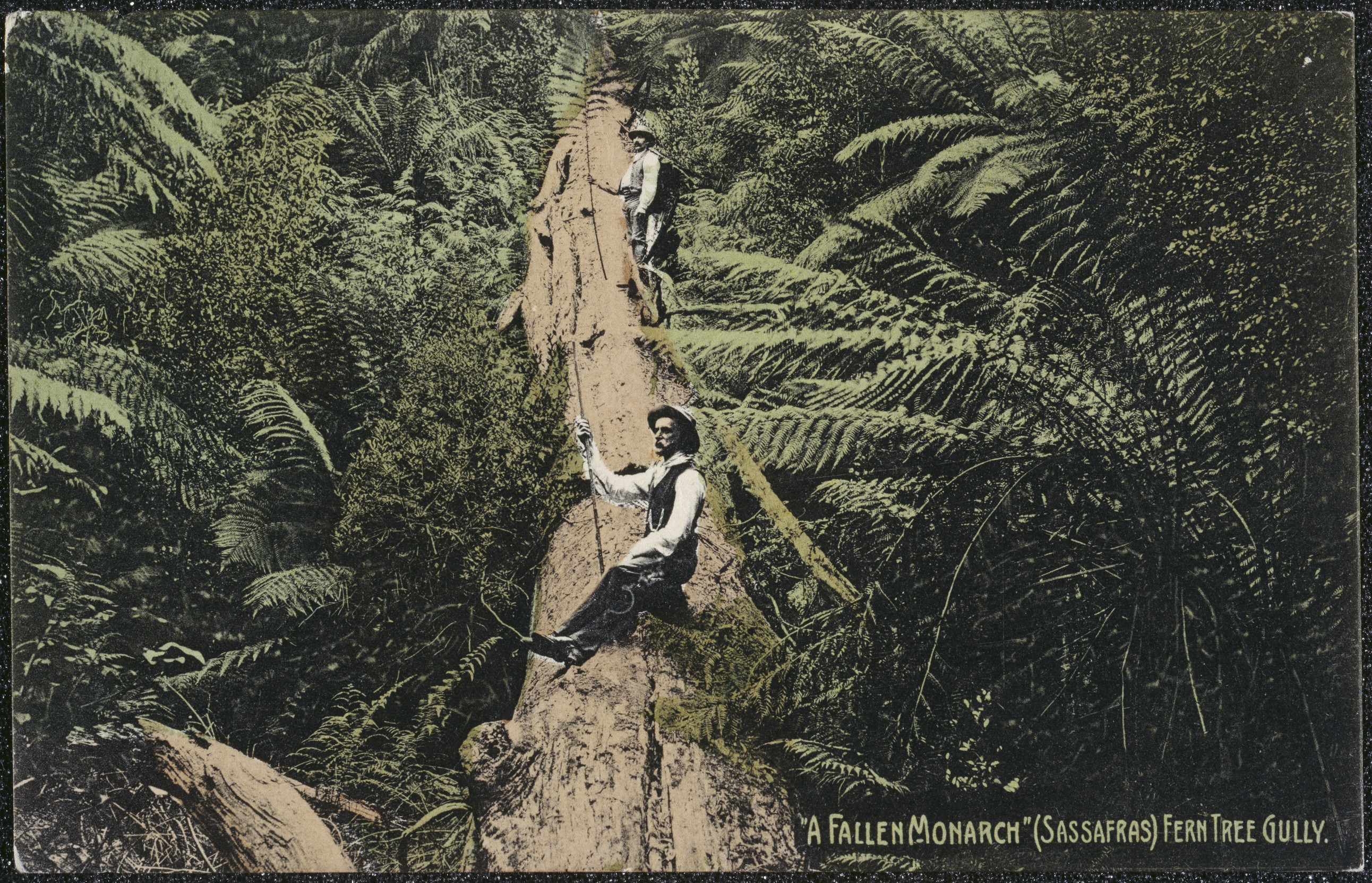
Postcard - A 'Fallen Monarch' (Sassafras), Fern Tree Gully, 1908.
Timbered country, either the Dandenongs or Mount Macedon, can be seen beckoning in the distance from most parts of Melbourne. The tall trees provide a great contrast with the suburbanised landscape. As the city grew, the forest was promoted as a place to go for spiritual and physical refreshment, or to renew one's soul. The Mountain Ash forests were promoted as 'the lungs of Melbourne'; they were seen as a health-giving environment, 'a sanitarium for all time', and they were enjoyed for their beauty and recreational value.
Some of the earliest popularisers of the mountain forests were painters influenced by the European artistic trends of the Picturesque and the Sublime. An influential early painting was Eugene Von Guerard's oil, Ferntree Gully in the Dandenong Ranges, painted in 1857. It was quickly approved as an accurate and emotive view and was reproduced in the Melbourne Illustrated News in the next year. It was one of the first of a long series of similar representations of wilderness subjects: of deep fern gullies, towering trees, plunging waterfalls and narrow valleys, often unpeopled, or showing humans standing on the edge of the scene, dwarfed by the grandeur of Nature.
Nineteenth century photographers, too, tried to capture the special nature of the mountain ash and fern forests. Nicholas Caire's images of the Black Spur and fern gullies around Marysville were among the most effective; they prompted Melburnians to visit and investigate the forests, and were used by tourism authorities for many decades to promote travel to the forests.
"Fairy scene at the Landslip, Blacks' Spur" - Nicholas Caire, c. 1878
The forest was within reach of day trippers. In 1869 the Lord Mayor of Melbourne organised a picnic of nearly 500 people to Fern Tree Gully, to welcome the Flying Squadron of the British Navy to Victoria. The trip took a full day, and the sailors and their ladies enjoyed the cool of the gully and marvelled at the trees and ferns. In 1889 the train line from Melbourne reached Fern Tree Gully, and Sunday excursions to the hills became very popular. In 1893 a reporter described how 'Almost every lady on her return to the train carried bunches of maiden hair, handfuls of green fern or bundles of the tall grasses which seemed to their simple trusting minds to have been produced for the ornamentation of suburban drawing rooms.' Day trips continued to be popular. In the 1920s, visitors to Mount Evelyn collected pink heath and gum tips and took them back to the city. By that stage, most of the ferns at Fern Tree Gully had gone, collected, vandalised or cleared out to make way for houses and roads.
A growing number of visitors stayed longer in the hills, spending a weekend or a week at one of the many guesthouses or hotels established in the forest. The 1920s were the heyday of forest holidays. Marysville, Healesville and Warburton all became popular holiday destinations, and in 1921 there were 81 boarding houses in the foothills of the Dandenongs. In some areas, areas of bush were sub-divided into small blocks and sold to people from the eastern suburbs who built shacks and gardens in the scrub.
The forests also attracted bushwalkers who hiked along some of the trails established during the gold rush, and who walked deep into the forest to reach the scattered timber towns. Walkers' huts were established along the most popular trails, and they remained until destroyed by the 1939 fire. Bushwalkers are motivated by a variety of things: appreciation of the bush, curiosity about the environment, a sense of personal challenge, a wish to record their physical achievements, or a need to escape, temporarily, the pressures of the city.
MM 5612 –
Item MM 5612 Negative - Bushwalkers at Warburton
The forests have become one of the playgrounds of Melbourne, especially in autumn, winter and spring. The increasing number of visitors has put its own pressures on the forest environment, while new types of recreational activities change the ways the forest is being experienced. The owners of four wheel drive vehicles, trail bikes and mountain bikes demand increased access along forest tracks. Most visitors now come by car; they require wider and better roads to whisk them into the forest. Authorities arrange 'natural' attractions to meet tourist expectations: they curve the roads to take advantage of the best views, and establish look outs along the route. Signs and brochures tell the tourist what to see, and nature trails are provided to point out privileged parts of nature. More facilities like restaurants, public toilets, look outs and picnic areas are required; and gradually suburban features have crept into the towns in the forest, so that a visit to the forest can be hedged around with familiar activities.
Tourism can be described as 'the mass production and management of sightseeing experiences'. There is a sense in which the forest experience is becoming more 'packaged', less 'different' each year, in response to the demands made by an increasing number of visitors. The forest's 'wilderness' aspects are tamed and controlled.
MM 110590 –
Item MM 110590 Digital Photograph - Boy Standing in Front of 'Puffing Billy' Steam Train
The indigenous people of Melbourne's east, the Kulin, chose to reside along the river valleys rather than in the 'cold country' of the Mountain Ash forests. They did, however, travel through the Mountain Ash forests on a seasonal basis, in search of food, shelter, material for fire, and tradeable goods.
The first Europeans to venture into the vast mountain forests north and east of Melbourne did not stay. The size of the trees, the darkness and dampness of the fern valleys, and the denseness of the vegetation made the mountain ranges unattractive and forbidding to those who were looking for land to farm; they preferred to settle the lesser-timbered land to the north and west.
'The Tree and the House Built from it' by Nicholas Caire
Gradually, European settlers began to explore the foothills, and eventually the ranges themselves; they carved narrow tracks and then roads through the valleys and hills, exploring for gold and other minerals, in search of pastoral land, and in search of the timber wealth of the forest
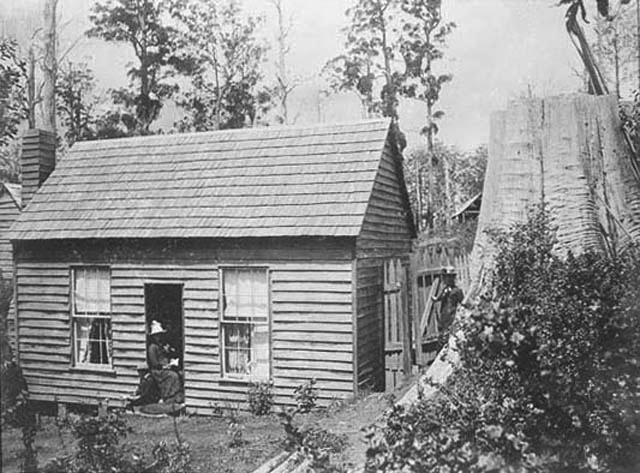
By the mid nineteenth century, all the 'easy' land in Victoria had been appropriated, and selectors began to take up land in the ranges and to start the long process of 'clearing' the Mountain Ash forest. Settlers began by ring-barking the trees on their block. This killed trees with the minimum of labour and let in the light to encourage grass growth.
It was hard work to clear the land, and many settlers fought a losing battle with bracken, saplings and other scrub. They often wrongly assumed that tall trees guaranteed rich and fertile soil. The farmer had to overcome wild pigs, horses, cockatoos, kangaroos, wombats and wallabies, and many blocks were abandoned, sometimes after a generation's work. It was quickly understood that not all the forest was suitable for agriculture or pastoral activities, so areas were reserved for timber.
BA 874 –
Item BA 874 Lantern Slide - 'Pioneer women at land clearing', The Dandenongs
Later settlers utilised new and developing technologies to harvest the resources of the forest. They took pride in their ingenuity as they found new uses for the land; they rejoiced in the increasing level of technical and engineering development; and they saw the changes in the landscape as evidence of the abilities of British settlers to turn a wilderness into a profitable land.
Nineteenth century colonists perceived their settlement of the land as 'improving' it; they used words like 'tame' and 'subdue' to describe what they were doing to the land. Their work in clearing the land was praised as a public good: in 1855 Howitt wrote that '...the axe, the plough and the fire of settlers will gradually and eventually remove' what he termed 'the evils' of the dense forest undergrowth.
Yet the pride in progress was tempered often by a sense of regret. Attitudes to the tall trees were ambivalent. After the 1939 bushfire, the Royal Commission was told that 'After the gold rush was over, the white man had to make use of the land and he had to get rid of the timber. He slaved, toiled and burned to get rid of it. ... the children and grand children of these men have grown up with minds opposed to timber.' However, pastoralists and settlers, even while they were busy trying to clear the trees from the land, were challenged and awed by the forest's secrecy, and sometimes felt a sense of loss as it was being destroyed.
Murrundindi creek in Toolangi State Forest
Acknowledgement
Material in these pages is largely drawn from the book by Tom Griffiths and Museum Victoria: Forests of Ash: An environmental history. Melbourne, Cambridge University Press, 2001.
Museums Victoria acknowledges the Wurundjeri Woi Wurrung and Boon Wurrung Bunurong peoples of the eastern Kulin Nations where we work, and First Peoples across Victoria and Australia.
First Peoples are advised that this site may contain voices, images, and names of people now passed and content of cultural significance.